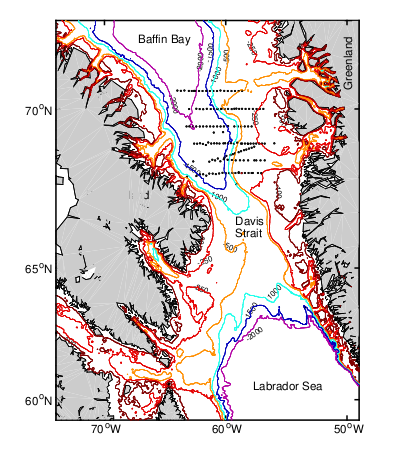
Cruises LEFE CYBER
GREEN EDGE
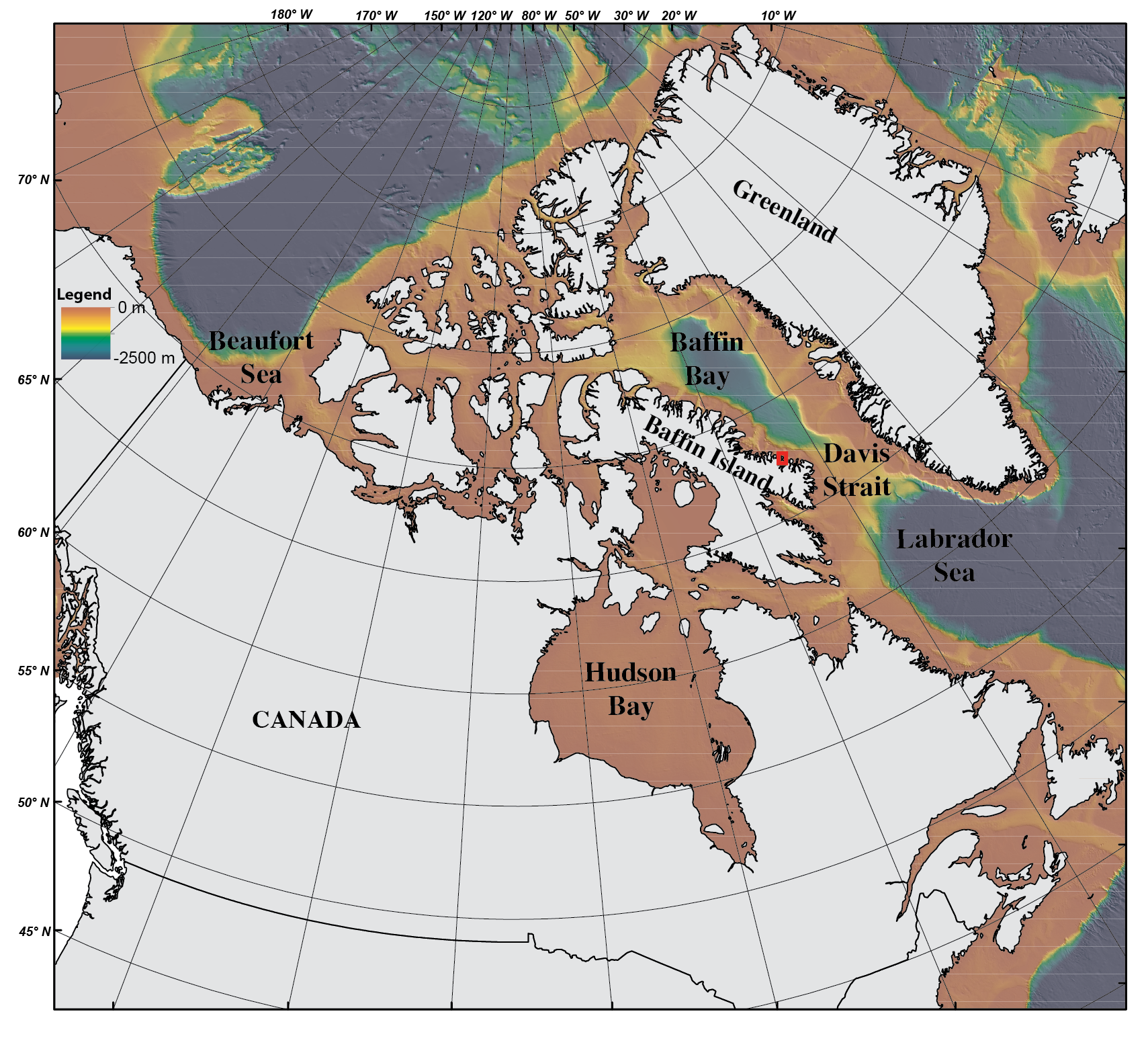
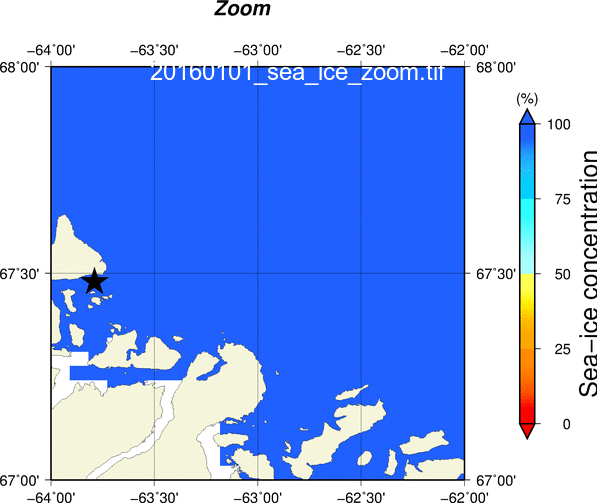
Location of the Green Edge Ice Camp site[67.47973333;-63.78953333]. Bathymetric data compiled from the International Bathymetric Chart of the Arctic Ocean (IBCAO). Red Square : Ice camp Location (Zoom)
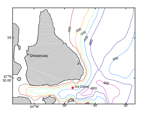
Location of the Green Edge Ice Camp site[67.47973333;-63.78953333]. Bathymetric data compiled from the CCGS Amundsen's high resolution (10-m grid) multibeam (Gabriel Joyal and Patrick Lajeunesse) and International Bathymetric Chart of the Arctic Ocean (IBCAO). Acknowledgment: Gabriel Joyal and Patrick Lajeunesse, Laboratoire de géosciences marines, Institut national de recherche scientifique (INRS). Data collected from 2003-2016 onboard the CCGS Amundsen within the ArcticNet research program.

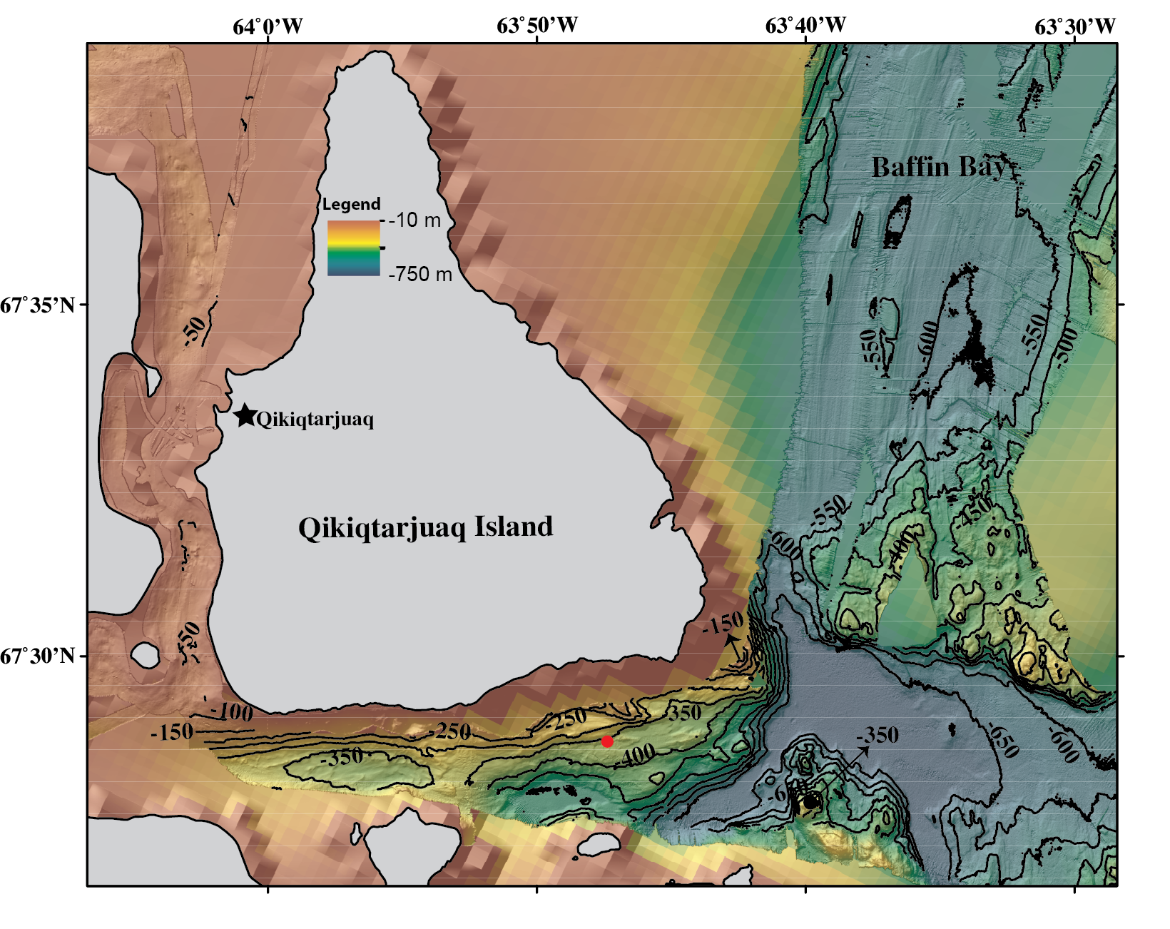
Green edge site: the bigger red square illustrate the sampling grid area for the ship-based cruise and the smaller red square indicate the location of the island of Qikiqtarjuaq. Bathymetric data compiled from the International Bathymetric Chart of the Arctic Ocean (IBCAO). (Zoom)
Location of the Green Edge Ice Camp site [67.47973333;-63.78953333]. Bathymetric data compiled from the International Bathymetric Chart of the Arctic Ocean (IBCAO, V3). Courtesy of E. Rehm
Location of the Green Edge Ice Camp site[67.47973333;-63.78953333]. Bathymetric data compiled from the International Bathymetric Chart of the Arctic Ocean (IBCAO,). V3 Courtesy of E. Rehm
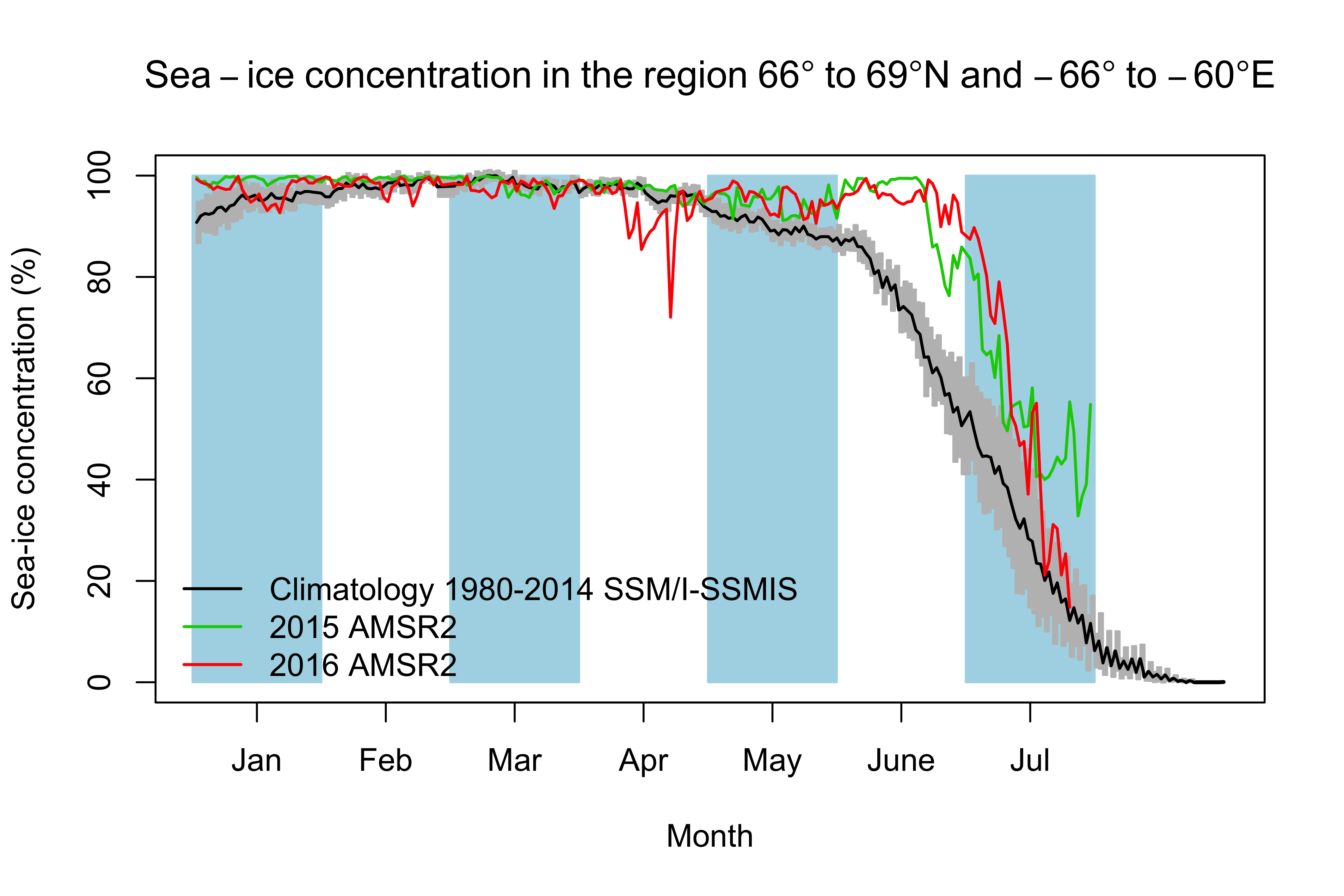
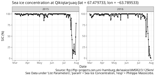
Sea/Ice concentration
Ice animation (Data Policy)

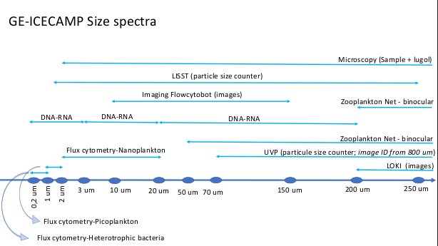
Flow cytometry analysis
D. Vaulot - Station Biologique de Roscoff.
Funding Agencies
International Programs