The objective of MOBYDICK is to study the links that exist between the biological pump of carbon and the food web structure. To address this issue MOBYDICK proposes a novel approach by considering the entire food web from microbes to top predators and by investigating the hitherto poorly studied relationships between biogeochemical fluxes and biodiversity. The dataset required to test the hypotheses proposed in MOBYDICK will be acquired during an oceanographic campaign off Kerguelen Island (Southern Ocean). In this well-documented area, 2 contrasted ecosystems "Low Biomass Low Export" and "High Biomass Low Export" coexist. MOBYDICK has gathered an international consortium to carry out a wide range of techniques for the determination of stocks, fluxes and biodiversity, which are rarely utilized simultaneously. The results will represent a milestone for fundamental knowledge, but they will also provide essential information for the sustainable management of these vulnerable ecosystems.
| Name | Lab. |
|---|---|
| Quéguiner Bernard | Mediterranean Institute of Oceanography (MIO) |
| Obernosterer Ingrid | Laboratoire d'Océanographie MICrobienne (LOMIC) |
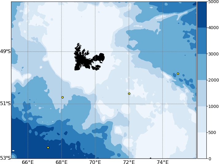
Map of the MOBYDICK station locations. The bathymetry is from NOAA ETOPO1 at 1 degree resolution.
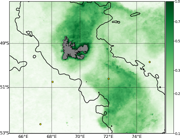
Map of the MOBYDICK station locations. Surface chlorophyll concentrations are Reprocessed Global Ocean Satellite Observations (Copernicus-GlobColour). Data are provided by Copernicus Marine Service. Chlorophyll concentrations are the monthly mean for March 2018 at a resolution of 4 km. The black lines denote 1000 m bathymetry.