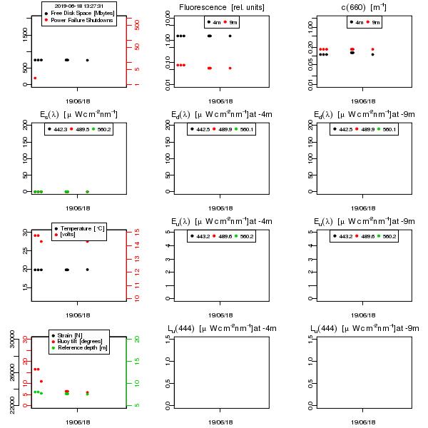
Daily data summary from the BOUSSOLE buoy.
The plot below shows the last 5 days of data acquisition by the buoy, as they are transmitted nearly hourly via the ARGOS satellite system. These data have not been quality controlled. They are just used as a near-real time rapid check of what's happening on the measurement site. In addition, the resolution of the data is degraded as compared to the full data set that is downloaded during the monthly buoy servicing cruises.
|
- "Fluorescence" is the phytoplankton chlorophyll fluorescence (measured at 685 nm, after excitation at 470nm)
- "c(660)" is the beam attenuation coefficient measured at 660 nm
- "Es(l)" is the spectral above-water downward irradiance
- "Ed(l)" is the spectral downward irradiance in the water column, at 4 & 9 meters
- "Eu(l)" is the spectral upward irradiance in the water column, at 4 & 9 meters
- "Lu(l)" is the spectral nadir upwelling radiance in the water column, at 4 & 9 meters
- "Temperature" is the water temperature recorded at a depth of approximately 9 meters
- "volts" is the buoy main computer battery voltage
- "Buoy tilt" is with respect to the local vertical
- "Reference depth" is the pressure measurement that should have a value of 8 meters when the buoy is stabilized and the sea surface is flat.
|
Link to monthly summaries of the real-time data collections |

Back to top